Initial Results from the 1998 Oklahoma Lightning Study
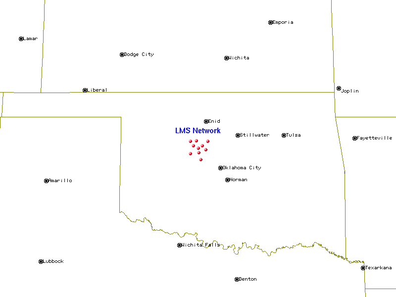
In May and June of 1998 the New Mexico Tech LMA system was deployed in
central Oklahoma. The ten stations were spread over an area of approximately
40 km by 40 km. The following maps show the locations of the LMA stations:
Map of LMA station locations in Oklahoma 
Map of Oklahoma 
Here are some MPG movies from the analyses of two lightning discharges in
Oklahoma. The plots have five windows in them:
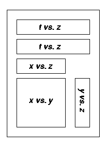
The top t vs. z plot shows all the points located in the given time
interval. The time is given in seconds, and the altitude z of the
radiation source is given in kilometers. The number of points can be limited
if desired. For example, two distinct discharges at different locations could
occur at the same time, so the operator may choose to look at only one of the
dishcarges in detail. Or the operator may narrow in on a particular event in
time which he does not want obsured by other data points. The lower four
plots show data points from the top plot which have been selected for such
reasons. The lower t vs. z plot shows the time development of the
altitude of the selected points. The x vs. y plot shows a plan view
of the lightning discharge, where x is the distance east or west of the
center of the array, and y is the distance north or south of the center.
All distances are given in kilometers. The small squares in the x vs.
y plot show the locations of the LMA stations. The x vs. z
and y vs. z plots show the projections of the points on the
xz and yz planes.
- Discharge showing distinct charge layers at different elevations.
Note the development of the dendritic structure of the discharge.
11 June 1998 06:33:20 UTC (645 KB Animated GIF)
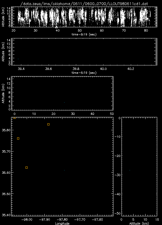
- Cloud-to-ground discharge followed by intercloud discharge. Note the
well-defined leaders in the CG. The triangles are locations and times of CG
strokes as determined by the National Lightning Detection Network. Note that,
in the CG, positive streamers propagate in the negative charge region, radially
away from the area of initial breakdown. The subsequent IC develops over the
top of of the CG.
11 June 1998 06:19:39 UTC (1.5 MB Animated GIF)
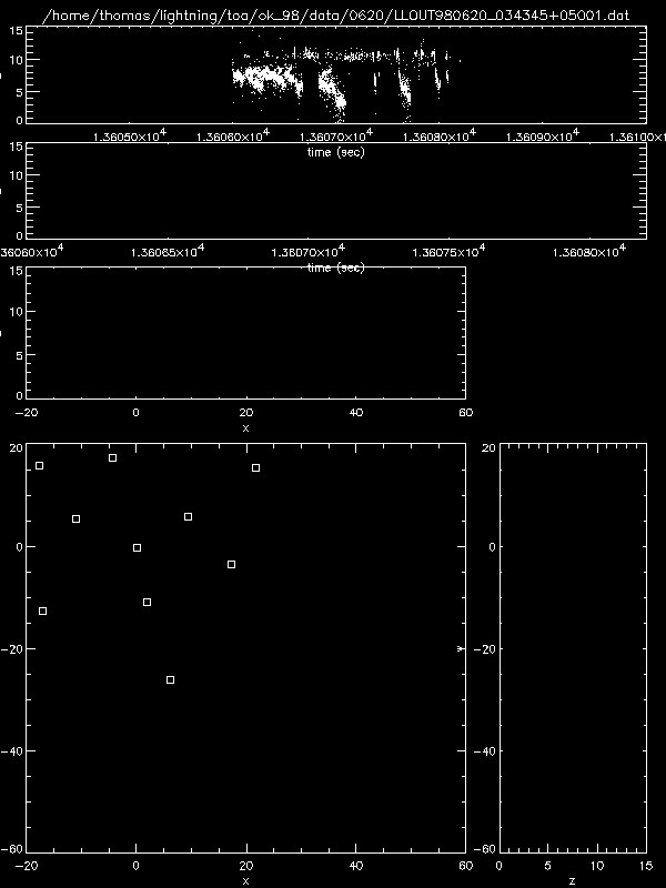
- Discharge near the end of a storm which appears to be inverted. There
are two distinct charge layers, but streamers appear to originate in the upper
layer and propogate to the lower layer. This is inverted from most intercloud
discharges in which negative streamers originate in the lower negative charge
layer and propogate into the upper positive charge layer. Also note how the
lower charge region decreases in altitude to the east.
20 June 1998 03:43:45 UTC (1.8 MB Animated GIF)
