1998 Oklahoma Network and Observations
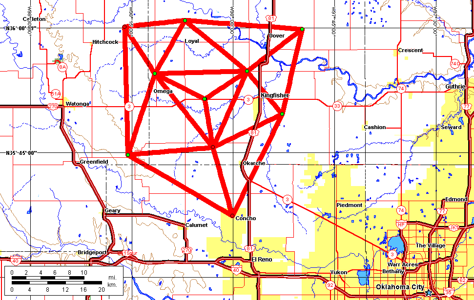
Map of the network operated in central Oklahoma during June, 1998 during the MEaPRS project, for comparison with the planned STEPS network. The STEPS network is about 50% larger in diameter and will provide greater areal coverage.
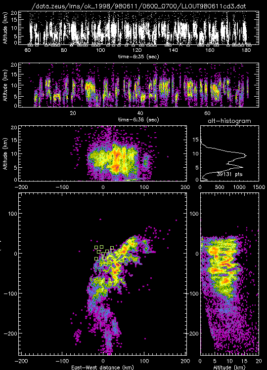
Three minutes of lightning activity in a line of thunderstorms over central Oklahoma on the evening of June 10-11, 1998, obtained with a 10-station version of the Lightning Mapping Array. The array was about 60 km in diameter and provided good 3-dimensional coverage over a 100 km diameter area, and detected lightning with decreasing accuracy out 200 km range (400 kilometer diameter). The STEPS array will be about 100 km in diameter and will provide correspondingly greater areal coverage.
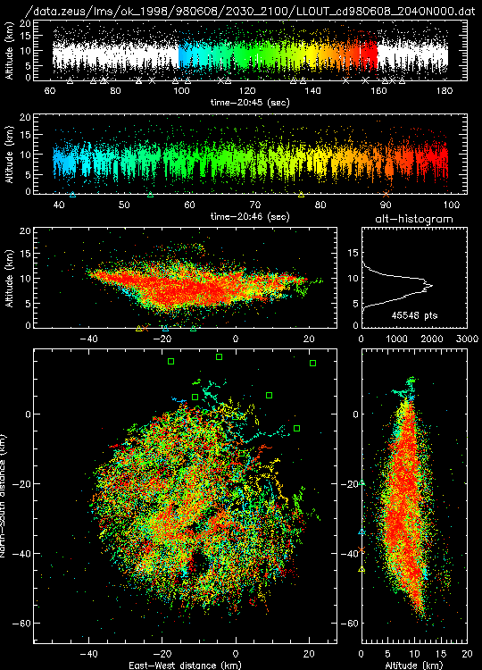
Lightning during a one-minute time interval in a 60km diameter supercell storm over central Oklahoma, showing the essentially continuous and volume-filling nature of the discharges. The lightning-free region or `hole' in the south part of the storm is believed to be the location of a strong updraft. This is further indicated by the occurrence of a number of minor discharges above 15 km altitude (msl) above the hole; such discharges have been found to be associated with overshooting tops in large storms.
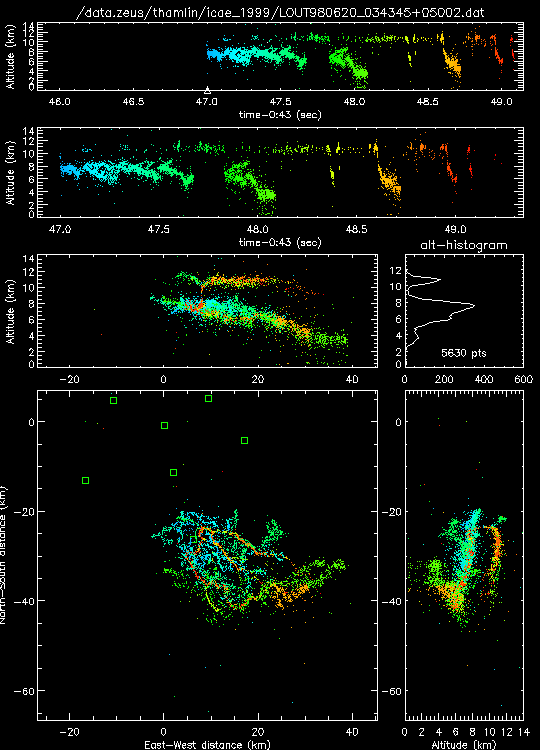
An inverted polarity intracloud discharge in a dissipating storm that was producing positive cloud-to-ground lightning discharges. The anomalous electrification that leads to such discharges is one of the subjects of the STEPS investigations.