Comparison of Intracloud Discharge and Storm Radar Echo
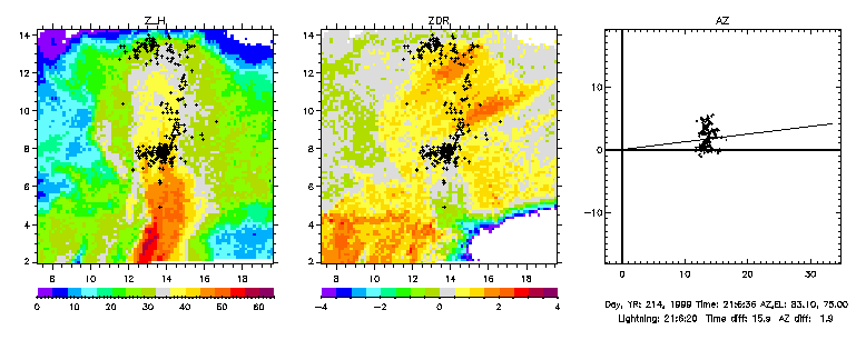
Comparison of the radiation sources from an intracloud lightning discharge with a vertical cross-section of the radar echo through the center of the storm. The discharge occurred between main negative charge at 7-8 km msl and upper positive charge between 12-14 km msl. The discharge was initiated by an energetic positive bipolar breakdown event in the vicinity of the negative charge region, but was otherwise normal. The radial bands in the differential reflectivity (ZDR) panel indicate the presence of electrically aligned ice crystals in the upper part of the storm. The panel on the right shows the lightning data in plan view and the radar scan plane.
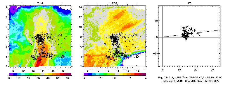
Comparison of the radiation sources from a subsequent cloud-to-ground discharge with the same radar cross-section. The discharge removed negative charge from within the main precipitation shaft at the same altitude as the preceding IC flash and lowered it to ground. In the process it appeared to discharge lower positive charge in the vicinity of the 0 degree isotherm, between 4-5 km msl.
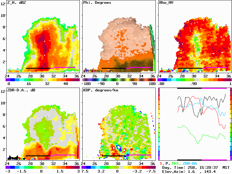
Vertical cross-section through a relatively small but convectively vigorous New Mexico storm, showing a complete set of dual-polarization variables obtained from circularly polarized transmissions. The Z_H panel shows that the storm produced 40 dBZ reflectivity up to about 8 km altitude (above ground level), or 9.5 km msl, and 50+ dBZ echoes in the precipitation core aloft. The orange-red colors in the differential reflectivity (ZDR) panel show where liquid drops existed in the storm; the drops were located at and below the 0 degree isotherm at about 3 km altitude agl (4.5 km msl). The vertical shaft of reduced H-V correlation in the rho_hv panel indicate the presence of irregularly shaped hail in the main precipitation shaft of the storm. The hail started to melt at a relatively low altitude in the ZDR panel. The KDP panel shows the rate of change of the differential phase with range; the relatively large values in the coupled red-blue region are due to differential phase upon backscatter from large liquid drops in that part of the storm. The lower right panel shows the profile of the different variables along the black-magenta range cursor through the rain region of the storm. (For more information, see paper under Publications in main page.)
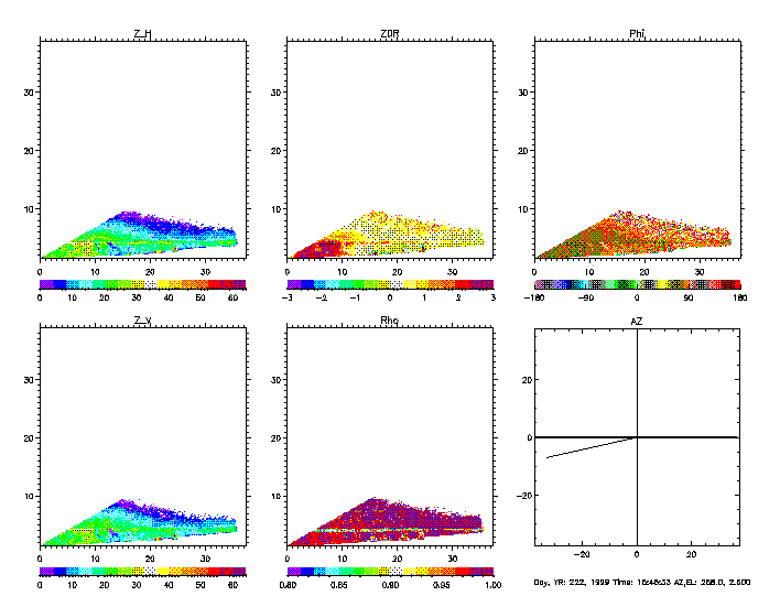
RHI scan through widespread storm with brightband. In the plane of Balloon Hangar at Langmuir Laboratory during Dave Rust balloon launch with 2 electric field mills. Balloon Hangar at 27.5 km from the radar.
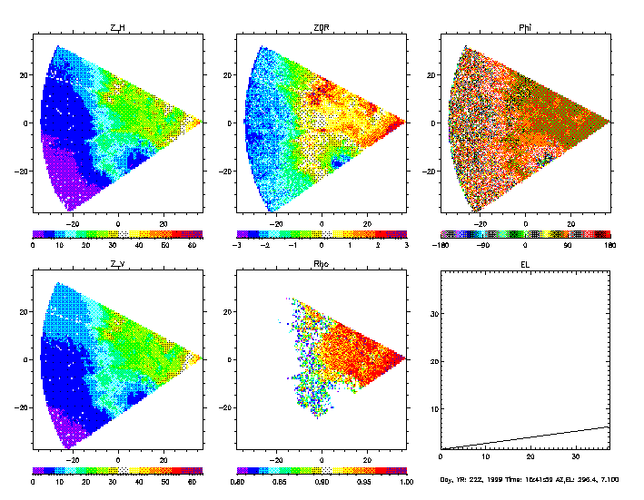
PPI scan through same storm, at 7.1 degrees elevation angle.
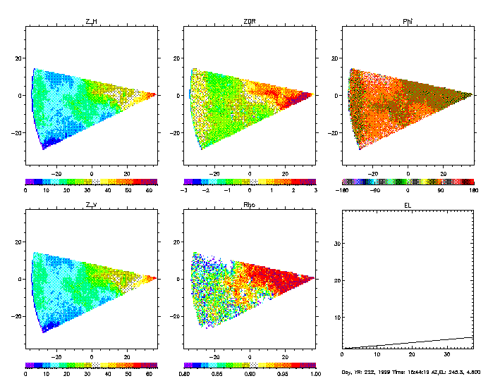
PPI scan at 4.8 degrees elevation angle.