Real-time data displayed as individual points

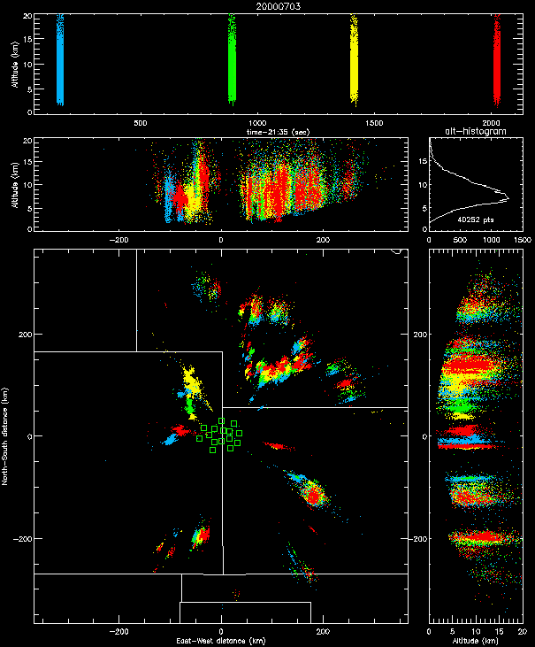
Shown below are additional examples of real-time data from STEPS. The first image shows the lightning activity later in the day on July 3 when the thunderstorm activity had become more widespread. Lightning was being detected well into Nebraska and as far south as the Oklahoma panhandle and extreme northeastern New Mexico. The curvature of the earth causes the lightning signals to be detected only from the upper part of the storm as the distance to the storm increases.
As initially implemented, the real-time system processed short samples of data typically 10-20 seconds in duration, that were brought back to the operations center via the communications links, analyzed, and displayed. In the display shown below we were monitoring the overall storm activity and the were sampling the data every ten minutes or so.
The first real-time observations during STEPS were obtained on June 18. They are obtained by remotely copying successive one-second time slices of the data from the remote stations to the operations center and processing them with fast C code developed by Jeremiah Harlin. The processed output could be displayed either with our normal display software, or with a simple version of the software that continually updated in real time. The display software is IDL-based and was developed by Ron Thomas.

The data display is from our standard `xlma' analysis program, which enabled us to interactively zoom in on particular storms and even particular discharges in the storms. With this capability we were quickly able to tell whether the intracloud lightning was of normal or inverted polarity, for example. Each dot in the display represents an individual radiation event from a 100 microsecond time window. Each mapping station typically triggers several thousand times a second (or more) while lightning is occurring. The mapping system locates several hundred to several thousand sources per second, depending on the level of activity.
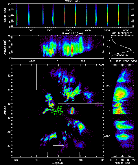
Shown below is one hour of data around the above time. Instead of showing the individual points, the density of points is displayed. The regions of most intense activity are shown in red, which highlight the convective cores of the storms. This type of display is particularly useful in generating animations of the overall storm activity.

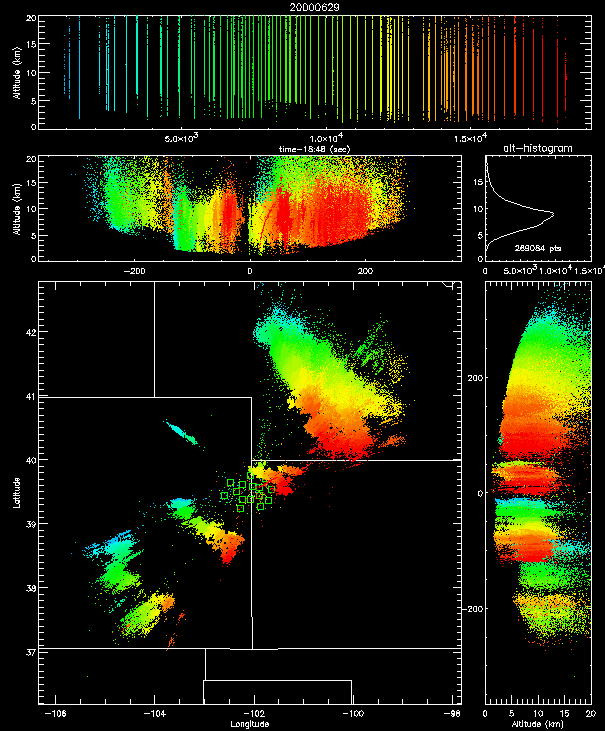
The real-time data can be accumlated over long periods of time and used to show the overall storm motion, as shown below. Radial errors are evident in the source locations as the distance from the network increases; these could be reduced or eliminated by deploying the network over a larger geographical area.

Accumulation of several hours of real-time data on June 29, showing the motion of the storms. The relatively small storm on the northeast edge of the mapping network produced an F1 tornado near the end of the time interval shown. Nearly 300,000 radiation events were located during the time period.
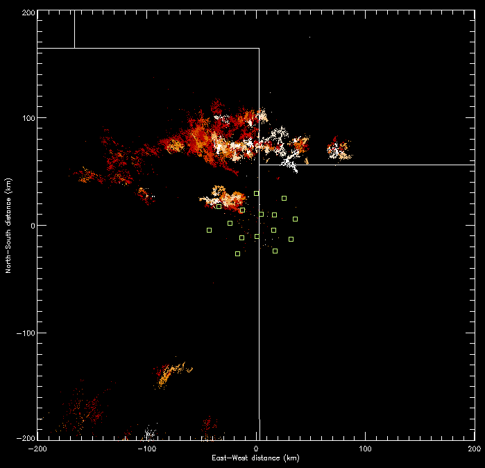
Finally, the image below shows the output of a simple real-time display that is continually updated and as the real-time data is generated. The display also ages the data as time passes. The observations shown are from July 20, 2000.

![[Go Back to STEPS 2000]](images/goback.jpg) Go Back to STEPS 2000
Go Back to STEPS 2000